Bolboschoenus planiculmis sl49
Description:
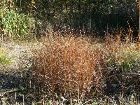
Description: Deutsch: Habitus Taxonym: Bolboschoenus planiculmis ss Fischer et al. EfÖLS 2008 ISBN 978-3-85474-187-9 Fundort: Renaturierungsbereich südlich des Egelseer Grabens 3,4 km WNW von Staatz, Bezirk Mistelbach, Niederösterreich - ca. 190 m ü. A. Standort: Ufer English: Habitus Taxonym: Bolboschoenus planiculmis ss Fischer et al. EfÖLS 2008 ISBN 978-3-85474-187-9 Location: renaturation area south of Egelseer Graben 3,4 km WNW Staatz, district Mistelbach, Lower Austria - ca. 190 m a.s.l. Habitat: shore. Date: 30 October 2021, 13:12:49. Source: Own work. Author: Stefan.lefnaer. Camera location48° 41′ 13.24″ N, 16° 26′ 58.17″ E View all coordinates using: OpenStreetMap 48.687012; 16.449493.
Included On The Following Pages:
- Life
- Cellular
- Eukaryota
- Archaeplastida (plants)
- Chloroplastida
- Streptophyta
- Embryophytes
- Tracheophyta
- Spermatophytes (seed plants)
- Angiosperms (Dicotyledons)
- Monocots (Monocotyledons)
- Commelinids
- Poales
- Cyperaceae
- Bolboschoenus (bulrush)
- Bolboschoenus planiculmis
This image is not featured in any collections.
Source Information
- license
- cc-by-sa-3.0
- copyright
- Stefan.lefnaer
- creator
- Stefan.lefnaer
- original
- original media file
- visit source
- partner site
- Wikimedia Commons
- ID