Ash near Hobarris - geograph.org.uk - 1110215
Description:
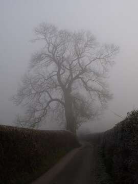
Summary.mw-parser-output table.commons-file-information-table,.mw-parser-output.fileinfotpl-type-information{border:1px solid #a2a9b1;background-color:#f8f9fa;padding:5px;font-size:95%;border-spacing:2px;box-sizing:border-box;margin:0;width:100%}.mw-parser-output table.commons-file-information-table>tbody>tr,.mw-parser-output.fileinfotpl-type-information>tbody>tr{vertical-align:top}.mw-parser-output table.commons-file-information-table>tbody>tr>td,.mw-parser-output table.commons-file-information-table>tbody>tr>th,.mw-parser-output.fileinfotpl-type-information>tbody>tr>td,.mw-parser-output.fileinfotpl-type-information>tbody>tr>th{padding:4px}.mw-parser-output.fileinfo-paramfield{background:#ccf;text-align:right;padding-right:0.4em;width:15%;font-weight:bold}.mw-parser-output.commons-file-information-table+table.commons-file-information-table,.mw-parser-output.commons-file-information-table+div.commons-file-information-table>table{border-top:0;padding-top:0;margin-top:-8px}@media only screen and (max-width:719px){.mw-parser-output table.commons-file-information-table,.mw-parser-output.commons-file-information-table.fileinfotpl-type-information{border-spacing:0;padding:0;word-break:break-word;width:100%!important}.mw-parser-output.commons-file-information-table>tbody,.mw-parser-output.fileinfotpl-type-information>tbody{display:block}.mw-parser-output.commons-file-information-table>tbody>tr>td,.mw-parser-output.commons-file-information-table>tbody>tr>th,.mw-parser-output.fileinfotpl-type-information>tbody>tr>td,.mw-parser-output.fileinfotpl-type-information>tbody>tr>th{padding:0.2em 0.4em;text-align:left;text-align:start}.mw-parser-output.commons-file-information-table>tbody>tr,.mw-parser-output.fileinfotpl-type-information>tbody>tr{display:flex;flex-direction:column}.mw-parser-output.commons-file-information-table+table.commons-file-information-table,.mw-parser-output.commons-file-information-table+div.commons-file-information-table>table{margin-top:-1px}.mw-parser-output.fileinfo-paramfield{box-sizing:border-box;flex:1 0 100%;width:100%}} Description: English: Ash near Hobarris The delicate outline of an ash looms out of the mist on the lane from Pen-y-wern to Hobarris. Date: 31 December 2008. Source: From geograph.org.uk. Author: Derek Harper. Attribution(required by the license)InfoFieldDerek Harper / Ash near Hobarris / CC BY-SA 2.0. InfoFieldDerek Harper / Ash near Hobarris. Camera location52° 23′ 52.9″ N, 3° 01′ 00″ W View all coordinates using: OpenStreetMap 52.398020; -3.016800. Object location52° 23′ 52.3″ N, 3° 00′ 59″ W View all coordinates using: OpenStreetMap 52.397850; -3.016300.
Included On The Following Pages:
- Life (creatures)
- Cellular (cellular organisms)
- Eukaryota (eukaryotes)
- Archaeplastida (plants)
- Chloroplastida (green plants)
- Streptophyta
- Embryophytes
- Tracheophyta (ferns)
- Spermatophytes (seed plants)
- Angiosperms (Dicotyledons)
- Eudicots
- Superasterids
- Asterids
- Lamiales ("An Order: Mints, Vervains, Snapdragons, Etc.")
- Oleaceae (olive family)
- Fraxinus (ash)
This image is not featured in any collections.
Source Information
- license
- cc-by-sa-3.0
- copyright
- Derek Harper
- creator
- Derek Harper
- source
- From geograph.org.uk
- original
- original media file
- visit source
- partner site
- Wikimedia Commons
- ID