Cheilanthes parryi - Flickr - aspidoscelis
Description:
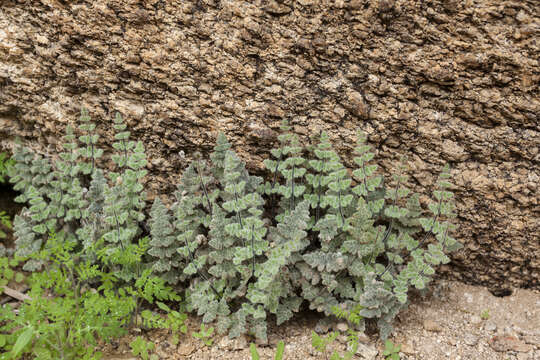
Description: Cheilanthes parryi, southeast of Tank Pass, between the Harcuvar Mountains and Granite Wash Mountains, north-northeast of Salome Peak and southwest of Harcuvar Peak, 33.862 -113.698, La Paz County, Arizona, 17 Feb 2017. Date: 17 February 2017, 10:15. Source: Cheilanthes parryi. Author: Patrick Alexander from Las Cruces, NM. Camera location33° 51′ 43.2″ N, 113° 41′ 52.8″ W View all coordinates using: OpenStreetMap 33.862000; -113.698000.
Included On The Following Pages:
- Life
- Cellular
- Eukaryota (eukaryotes)
- Archaeplastida (plants)
- Chloroplastida
- Streptophyta
- Embryophytes
- Tracheophyta
- Polypodiopsida
- Polypodiales
- Pteridaceae (maidenhairs and shoelace ferns)
- Myriopteris
- Myriopteris parryi (Parry's lipfern)
This image is not featured in any collections.
Source Information
- license
- cc-publicdomain
- creator
- Patrick Alexander
- source
- Flickr user ID aspidoscelis
- original
- original media file
- visit source
- partner site
- Wikimedia Commons
- ID